
About OGCR project
The Intergenerational Open Geospatial Carbon Registry (OGCR) is a HORIZON-RIA HORIZON Research and Innovation Actions funded project running from June 2025 till June 2029. OGCR project aims to create:
- Updateable baseline geospatial layers for soil, biomass and peat for pan-EU,
- A hybrid modelling framework to explore management changes in CAP and CRCF initiatives, and
- A globally applicable open geospatial carbon registry, servicing pan-EU.
We will use a genuinely transparent stakeholder co-design & consultative development process to build software interfacing between CRCF and CAP activities with mandatory and voluntary markets. Above and below ground carbon reduction and farming activities will be measured, monitored and independently verified. The system will attract both small and big landholder participation through:
- An innovative geospatial carbon accountancy framework that fairly rewards landholders for avoiding and sequestering carbon over generations,
- Applicability to all lands independent of management, and
- Easy access to geospatial information on past, present and possible future states for soil carbon, biomass and peat soils under different managements.
In a nutshell, OGCR will produce a number of next-generation data sets that will be released under an open data license this includes:
- 10 m resolution spacetime SOC predictions in 3D+T for pan-EU 2017–2024+ using data driven approaches;
- 30 m resolution spacetime SOC predictions in 3D+T for pan-EU 2000–2024+ using data driven approaches;
- 30 m resolution spacetime AGB predictions in 2D+T for pan-EU 2000–2024 using data driven approaches;
- 10 m resolution spacetime aboveground biomass predictions in 2D+T for pan-EU 2017–2024+ using data driven approaches;
- 30 m and 10 m resolution forest tree species distribution maps for pan-EU 2000–2024+;
- 30 m and 10 m resolution CFCF hotspots pan-EU data set 2024;
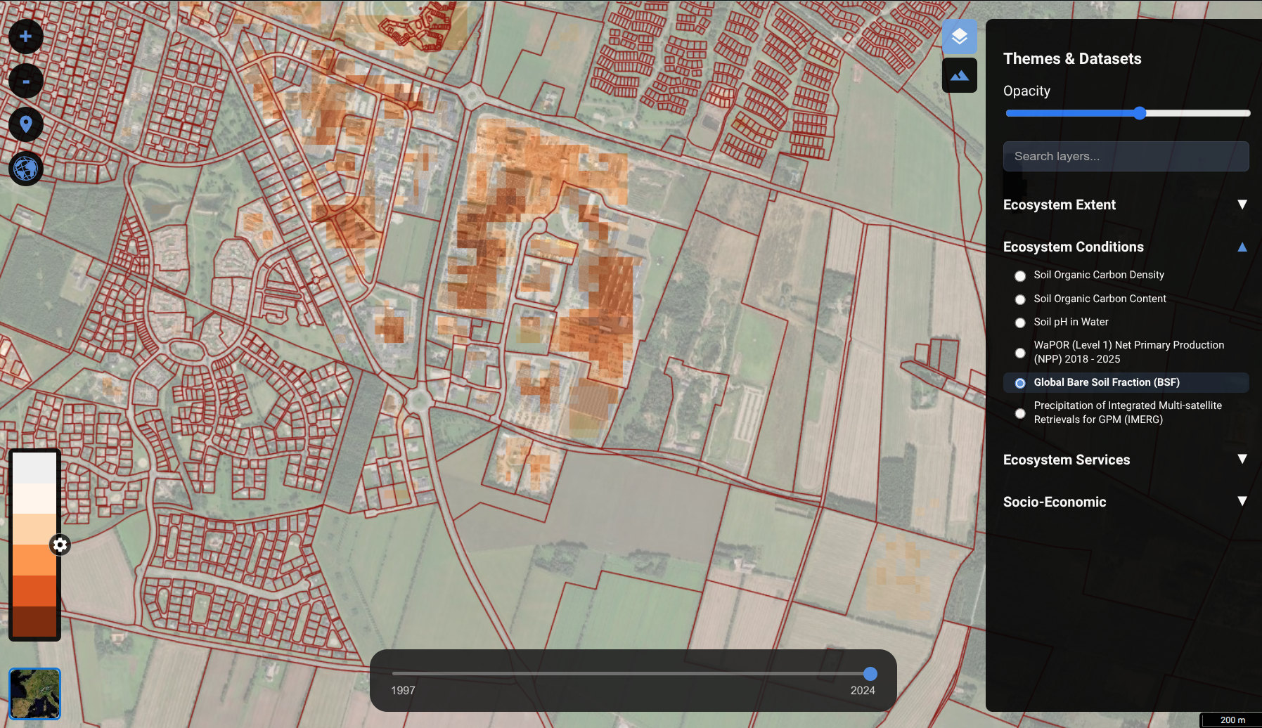
These data sets will be combined with the European digital cadastral data and dynamic and fixed monitoring stations to produce an OGCR API. The OGCR API will serve:
- Basic geospatial data including above and below ground biomass (with prediction intervals) for 2000–2024+ (30 m resolution) and 2017–2024+ (10 m resolution), National cadastral data, EU-wide administrative units: about 120TB of data;
- Aggregate outputs showing changes in above and below ground biomass per administrative unit i.e. cadastral unit and/or NUTS3 level units;
- Sampling designs (per cadastral unit) with an explanation how to conduct sampling and how to submit and register data;
- Short report on how were the predictions derived, how was uncertainty estimated and how to use the data;
Project outputs:
You can follow the OGCR project through the following channels:
- Data sets contributed: Zenodo.org,
- Publications produced: Zotero.org,
- Code, tutorials and blog posts: Codeberg.org,
- Video recordings: av.TIB.eu,
Follow us:
Follow us on social media:
- Newsletter,
- Mastodon,
- Telegram,
- Mattermost (internal users only),